
NewsTampa Bay TimesAugust 14, 2026Hillsborough County
National Hurricane Center monitors two tropical waves in the Atlantic
Photo: Tampa Bay Times
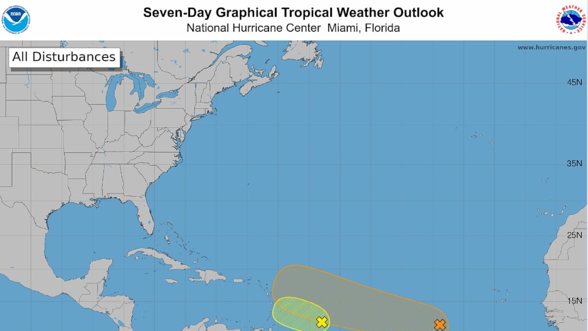
The National Hurricane Center is tracking two tropical waves, Invest 92 and Invest 94, for potential development into tropical depressions or storms. While Invest 92 has a low chance of development, Invest 94 is being monitored for possible movement toward the Caribbean and potentially Florida.
Read the full story at Tampa Bay TimesWhy It Matters
Residents in Florida and the Caribbean are advised to monitor weather updates as tropical systems can develop rapidly and impact local safety, infrastructure, and emergency preparedness plans.
Key Facts
- Invest 92 has a 20% chance of development over the next two to seven days.
- Invest 94 has a 30% chance of development in the next two days and 50% in the next seven days.
- The 2026 Atlantic hurricane season runs from June 1 through Nov. 30.
- NOAA forecasts between seven and 13 named storms for the 2026 season.
- NOAA predicts between two and six hurricanes for the 2026 season.
- An average hurricane season typically sees 14 named storms and seven hurricanes.
- The peak of the hurricane season occurs between mid-August and mid-October.
- Only three named systems have formed so far in the 2026 season: Arthur, Bertha, and Cristobal.
Who's Mentioned
locationFlorida“Potential area of impact for developing weather systems.”otherInvest 94“A tropical wave located in the central tropical Atlantic.”OrganizationNational Oceanic and Atmospheric Administration“Provided the seasonal hurricane forecast.”otherInvest 92“A tropical wave located east of the Windward Islands.”OrganizationNational Hurricane Center“The federal agency responsible for tracking tropical weather systems.”