
NewsWPLG Local 10 – Main FeedAugust 30, 2026Miami-Dade County
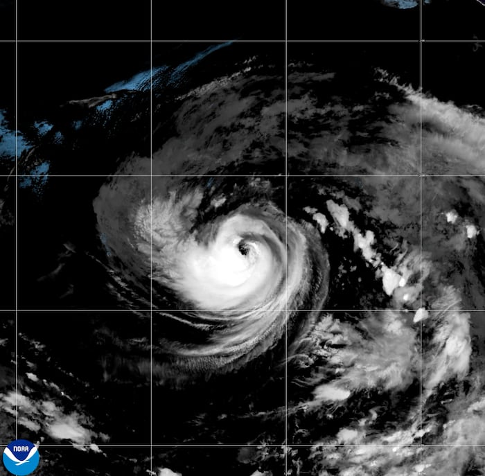
National Hurricane Center tracks Hurricane Karina in the Pacific
Photo: WPLG Local 10 – Main Feed
Tropical Storm Karina has strengthened into a Category 1 hurricane in the Pacific Ocean, with forecasters expecting it to remain at sea away from land. While the storm poses no direct threat to land, it is expected to generate dangerous surf and rip currents along the coasts of southwest Mexico and the Baja California Peninsula.
Read the full story at WPLG Local 10 – Main FeedWhy It Matters
Residents and travelers in coastal areas of southwest Mexico and the Baja California Peninsula should be aware of potential hazardous surf and conditions caused by the storm's swells this week.
Key Facts
- Hurricane Karina has maximum sustained winds of 80 miles per hour (130 kilometers per hour).
- The storm is currently a Category 1 hurricane.
- Karina is located approximately 820 miles (1,325 kilometers) southwest of the southern tip of Mexico’s Baja California Peninsula.
- The storm is moving northwest at 15 miles per hour (24 kilometers per hour).
- Tropical Storm Lowell is located 1,150 miles (1,850 kilometers) southeast of Hawaii.
- The National Oceanic and Atmospheric Administration predicts eight to 14 named storms for the Atlantic season.
- The Atlantic season forecast includes three to six hurricanes and one to three major hurricanes.
- The Atlantic hurricane season is expected to be below-average due to El Nino.
Who's Mentioned
OrganizationNational Hurricane Center“Miami-based agency monitoring the storm”otherLowell“Tropical Storm in the Pacific”locationBaja California Peninsula“Coastal area affected by surf conditions”locationMexico“Coastal areas affected by surf conditions”OrganizationNational Oceanic and Atmospheric Administration“Forecasted the Atlantic hurricane season”locationHawaii“Reference point for Tropical Storm Lowell”otherKarina“Hurricane currently in the Pacific”