
NewsTampa Bay TimesOctober 27, 2026Hillsborough County
Record-Breaking King Tides Swamp South Florida Infrastructure and Streets
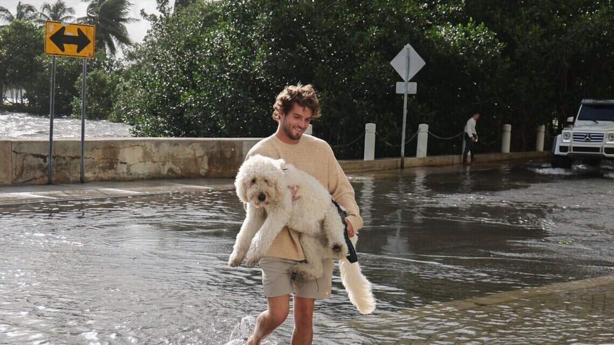
Photo: Tampa Bay Times
An unprecedented king tide fueled by onshore winds and sea level rise submerged major South Florida roads, trapped coastal residents, and overwhelmed drainage systems from Miami to West Palm Beach. Fort Lauderdale officials temporarily shut down the Las Olas Bridge due to severe flooding, while regional water management barriers reversed flow and pushed water back into canals.
Read the full story at Tampa Bay TimesWhy It Matters
Coastal residents and businesses face severe daily disruptions, impassable roads, and property damage as sea level rise strains infrastructure built over eight decades ago, risking millions of people and billions in real estate value.
Key Facts
- South Florida experienced what scientists and records indicate is the highest king tide in the region's history outside of a tropical storm or hurricane.
- Both Fort Lauderdale and Miami registered about 2.5 feet of water above high tide, classified as 'major' flooding by the National Weather Service.
- Miami’s Virginia Key tide gauge recorded the highest water level outside of a hurricane since its installation in 1994, closely approaching the record set by Hurricane Irma in 2017.
- Port Everglades tide gauges broke the record set in September, measuring the highest flooding at the station since installation in 2018.
- Fort Lauderdale officials shut down the Las Olas Bridge due to severe water accumulation on both sides.
- Flood control barriers installed by the South Florida Water Management District failed to let water flow out, causing water to flow backward over barriers into canals in Miami Shores, Little River, and North Miami Beach.
- The South Florida Water Management District previously secured and then lost $150 million in federal BRIC funding in 2025 before the grants were recently reinstated for construction and permitting.
- Miami has experienced roughly 8 inches of sea level rise since 1994, contributing to prolonged high-tide flooding hours.
- Scientists predict South Florida could see up to two feet of sea rise by 2060 and up to six feet by 2100.
Who's Mentioned
locationMiami“South Florida city affected by flooding”OrganizationNational Weather Service“Federal agency classifying flood levels”locationWest Palm Beach“South Florida city affected by flooding”OrganizationSouth Florida Water Management District“Regional agency managing water control structures”locationPort Everglades“Location of tide gauges breaking flood records”locationVirginia Key“Location of Miami's tide gauge”PersonMaria Martell“Resident on Crespi Boulevard in Miami Beach”OrganizationUniversity of Miami’s Rosenstiel School of Marine and Atmospheric Research“Academic research institution”OrganizationFlorida Atlantic University’s Center for Urban and Environmental Solutions“University research center focused on urban solutions”PersonGonzalo E. Vazquez“Investment banker living in Hendricks and Venice Isles”locationNorth Miami Beach“Area with flood control structures”locationLittle River“Miami area with flood control structures”locationFort Lauderdale“Coastal city experiencing bridge closures and street flooding”locationBiscayne Bay“Water body connected by regional canal barriers”PersonRobert Tate“Retired police lieutenant who walks along the Las Olas Bridge”PersonClaudia Stevens“North Beach neighborhood resident”PersonBrian McNoldy“Senior research associate at the University of Miami’s Rosenstiel School of Mari”PersonJason Schultz“District spokesman for the South Florida Water Management District”PersonPedro Arraz“21-year-old manager at Chima’s Steakhouse Fort Lauderdale”PersonSerena Hoermann“Director of Florida Atlantic University’s Center for Urban and Environmental Sol”PersonLuis Chavez Espinosa“Miami Beach neighborhood resident”locationMiami Beach“Coastal city experiencing severe saltwater surges”