
NewsFox 13 News (WTVT) — All NewsSeptember 14, 2026Hillsborough County
National Hurricane Center monitors Atlantic storm system as drier air briefly reaches Florida
Photo: Fox 13 News (WTVT) — All News
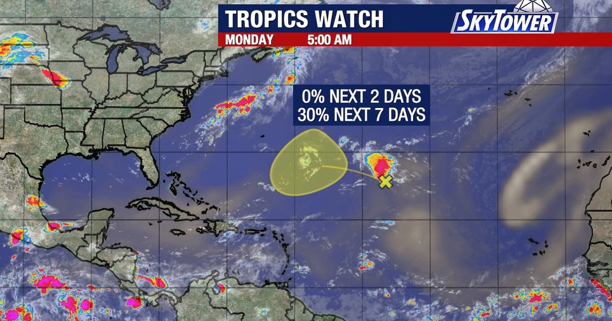
A storm system in the middle of the Atlantic holds a 30% chance of development but poses no immediate threat, while a brief patch of drier air reaches parts of Central Florida before humidity returns later in the week.
Read the full story at Fox 13 News (WTVT) — All NewsWhy It Matters
Residents along and north of the Interstate 4 corridor will experience a brief drop in humidity on Wednesday before muggy conditions return on Thursday.
Key Facts
- An area of storms in the middle of the Atlantic has a 30% chance of development according to the National Hurricane Center.
- Meteorologists do not expect the Atlantic system to pose a threat because prevailing weather patterns would push it out.
- Model support for the development of the Atlantic system is limited.
- The Caribbean and Gulf of Mexico remain quiet.
- A small amount of drier air could push south to the Interstate 4 corridor on Wednesday.
- Areas north of Tampa will see a brief break from humidity that is expected to return on Thursday.
Who's Mentioned
locationCaribbean“Region noted as remaining quiet for now.”OrganizationFOX 13“Employer of Meteorologist Dave Osterberg.”locationTampa“Reference point for areas north experiencing a brief humidity break.”locationInterstate 4 corridor“Area where a small amount of drier air could push south on Wednesday.”locationGulf“Region noted as remaining quiet for now.”PersonDave Osterberg“FOX 13 Meteorologist who noted limited model support for storm development.”locationAtlantic Basin“Location of the monitored storm system.”OrganizationNational Hurricane Center“Provided the 30% development probability for the Atlantic storm system.”