
NewsABC7 News San Francisco (KGO-TV)October 29, 2026San Francisco County
Experts warn of heightened Bay Area flood risks from El Niño and rising sea levels
Photo: ABC7 News San Francisco (KGO-TV)
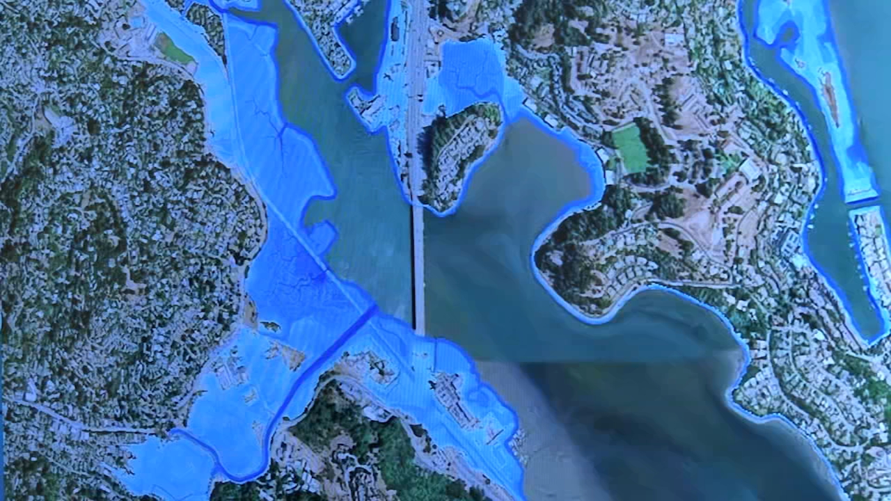
Climate experts and community organizations are warning Bay Area residents to prepare for severe winter flooding driven by a combination of El Niño storms, sea level rise, king tides, and warming ocean conditions. Officials have released interactive maps to help cities and residents assess vulnerabilities in low-lying shoreline areas across Marin County, the Peninsula, the South Bay, and the East Bay.
Read the full story at ABC7 News San Francisco (KGO-TV)Why It Matters
Residents in low-lying and levee-protected coastal neighborhoods face potential property damage and evacuation orders if severe winter storms coincide with high tides and thermal ocean expansion.
Key Facts
- Bay Area flooding risks this winter are heightened by a combination of El Niño, sea level rise, king tides, and warming ocean conditions.
- Thermal expansion from warming ocean water at the equator is projected to add about 12 inches of total additional water level.
- Vulnerable areas include low-lying and levee-protected sections of Marin County, parts of the Peninsula, South Bay communities like Alviso, and East Bay shoreline areas including Alameda and Oakland Airport.
- The San Francisco Bay Conservation and Development Commission has developed interactive maps to project potential flooding impacts and help cities and counties plan.
- Nonprofit groups like the Lemon Aide Project are encouraging residents to prepare emergency kits and evacuation plans.
Who's Mentioned
PersonShannon Parkhurst“Nonprofit leader with the Lemon Aide Project helping residents prepare.”OrganizationLemon Aide Project“Nonprofit organization helping neighbors prepare for potential flooding.”locationPeninsula“Region identified as particularly vulnerable to flooding.”locationBay Area“Region facing potential flooding threats this winter.”locationMarin County“Area with low-lying and levee-protected shoreline sections identified as vulnera”locationEast Bay“Region with significant stretches of shoreline identified as vulnerable.”OrganizationOakland Airport“Facility experiencing overtopping and flooding risks.”PersonDana Brechwald“Assistant planning director for climate adaptation at the San Francisco Bay Cons”locationSouth Bay“Region including communities such as Alviso identified as vulnerable.”locationAlameda“East Bay location with shoreline areas vulnerable to flooding.”locationNovato“City where flooding vulnerability was highlighted during a tour.”locationCalifornia“State coast where warm water masses are pushed by Kelvin waves.”OrganizationSan Francisco Bay Conservation and Development Commission“Commission that helped develop maps projecting potential flood impacts.”locationAlviso“South Bay community identified as vulnerable to flooding.”