
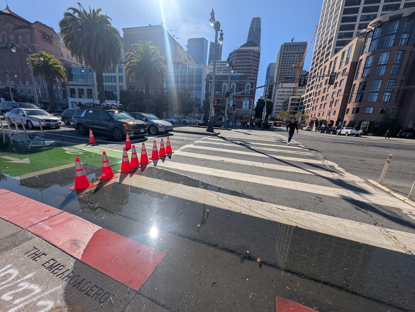
UC Davis report warns Bay Area faces heightened winter flood risks from El Niño and sea-level rise
Photo: The San Francisco Standard
A new UC Davis report warns that rising sea levels combined with a powerful El Niño and winter storms could push water two to three feet above current levels, threatening low-lying roads, airports, and neighborhoods. Coastal flood advisories remain in effect for San Francisco and the North Bay through Friday evening, with broader bay shorelines and Monterey Bay under advisories through Saturday. National Weather Service officials advise drivers to avoid flooded roads as seasonal king tides approach around Thanksgiving and Christmas.
Read the full story at The San Francisco StandardWhy It Matters
Residents in low-lying coastal and bay-adjacent areas face potential disruptions and property risks as winter storms and high tides threaten key transit corridors like Highway 101 and local neighborhoods.
Key Facts
- A new UC Davis Road Ecology Center report warns that sea-level rise combined with El Niño and winter storms could push water two to three feet above current levels.
- Sunny-day flooding caused water to spill over the sidewalk near Pier 14 on Wednesday, requiring caution tape.
- Coastal flood advisories are in effect until 5 p.m. Friday for the coastal North Bay and San Francisco, and until 6 p.m. Saturday for the San Francisco and San Pablo bay shorelines and Monterey Bay.
- California sea levels have risen nearly a foot due to climate change, with a Kelvin wave potentially adding a foot or more of warm water.
- King tides, the year's highest tides, are expected around Thanksgiving and Christmas and will coincide with full moons.
- Vulnerable locations identified in the report include San Francisco International Airport, stretches of Highway 101, parts of San Jose (Alviso and Renaissance), Marin County (Corte Madera and San Rafael's Canal Area), and an unmaintained levee east of the Petaluma River.
- Wednesday's high waters were driven by spring tides rather than king tides, showing water about a foot above normal on a tide gauge.